This page is also available in Icelandic ![]()
This case study consists of a Demonstrator Site. It does not have any Follower Site.
DS#7 - "Arctic" (Iceland)

The case study in 5 minutes

Location
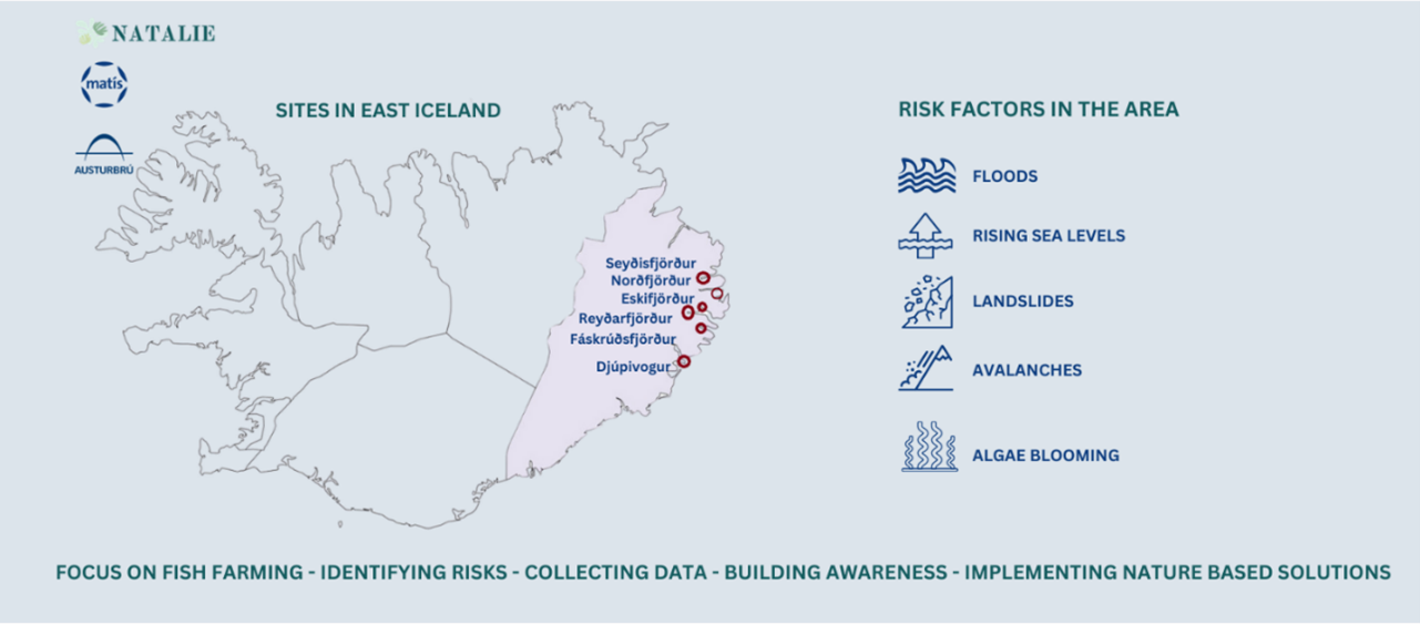
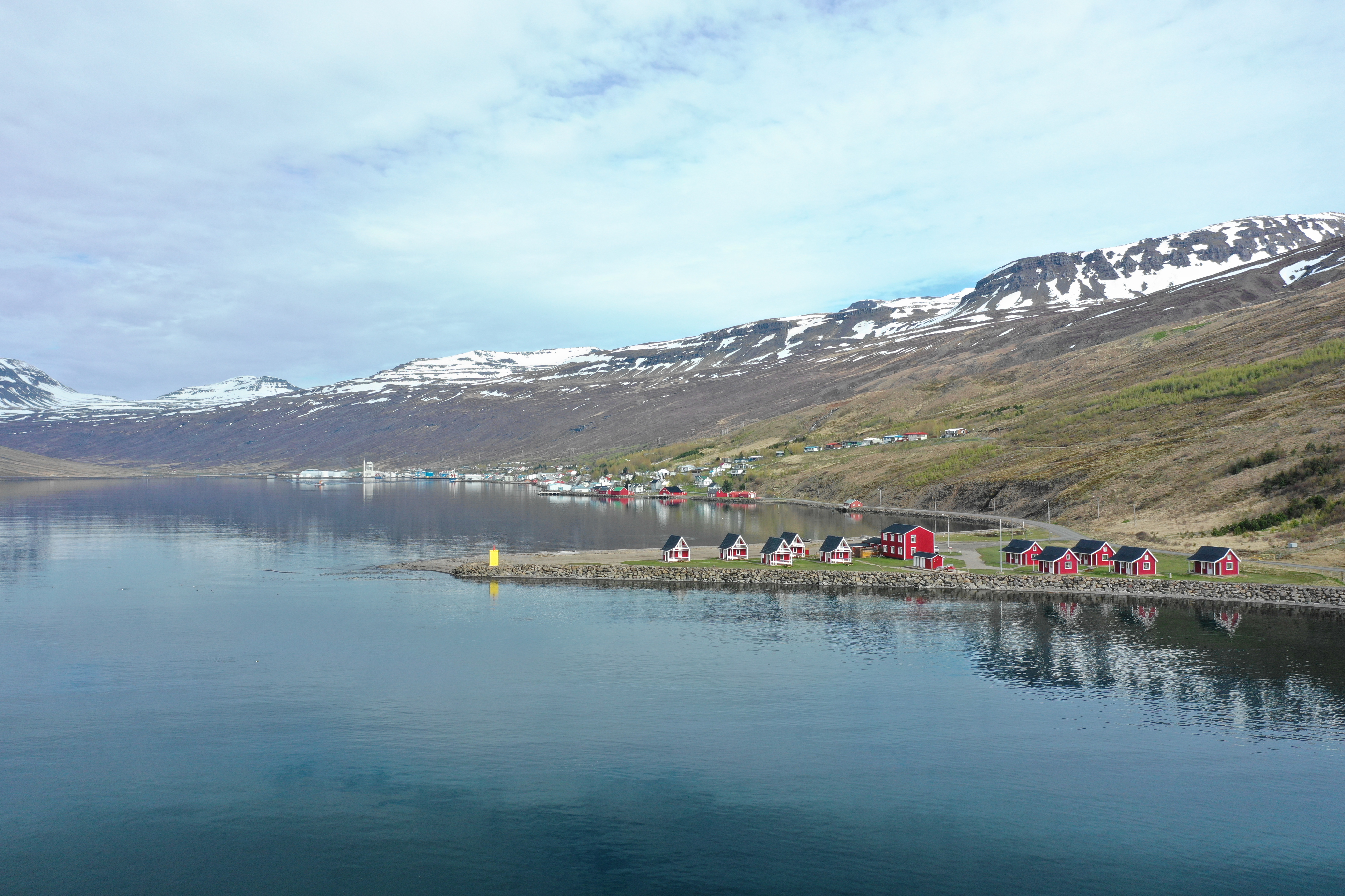
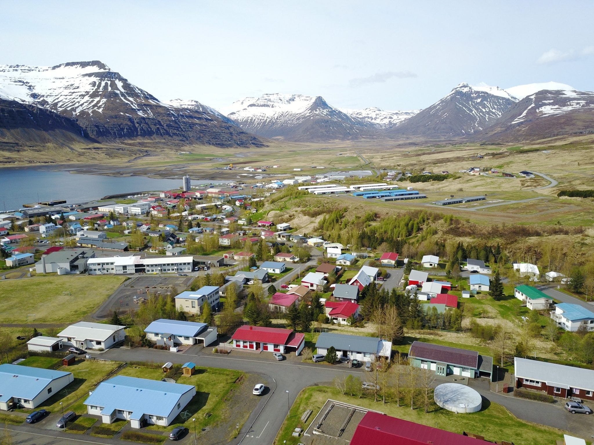
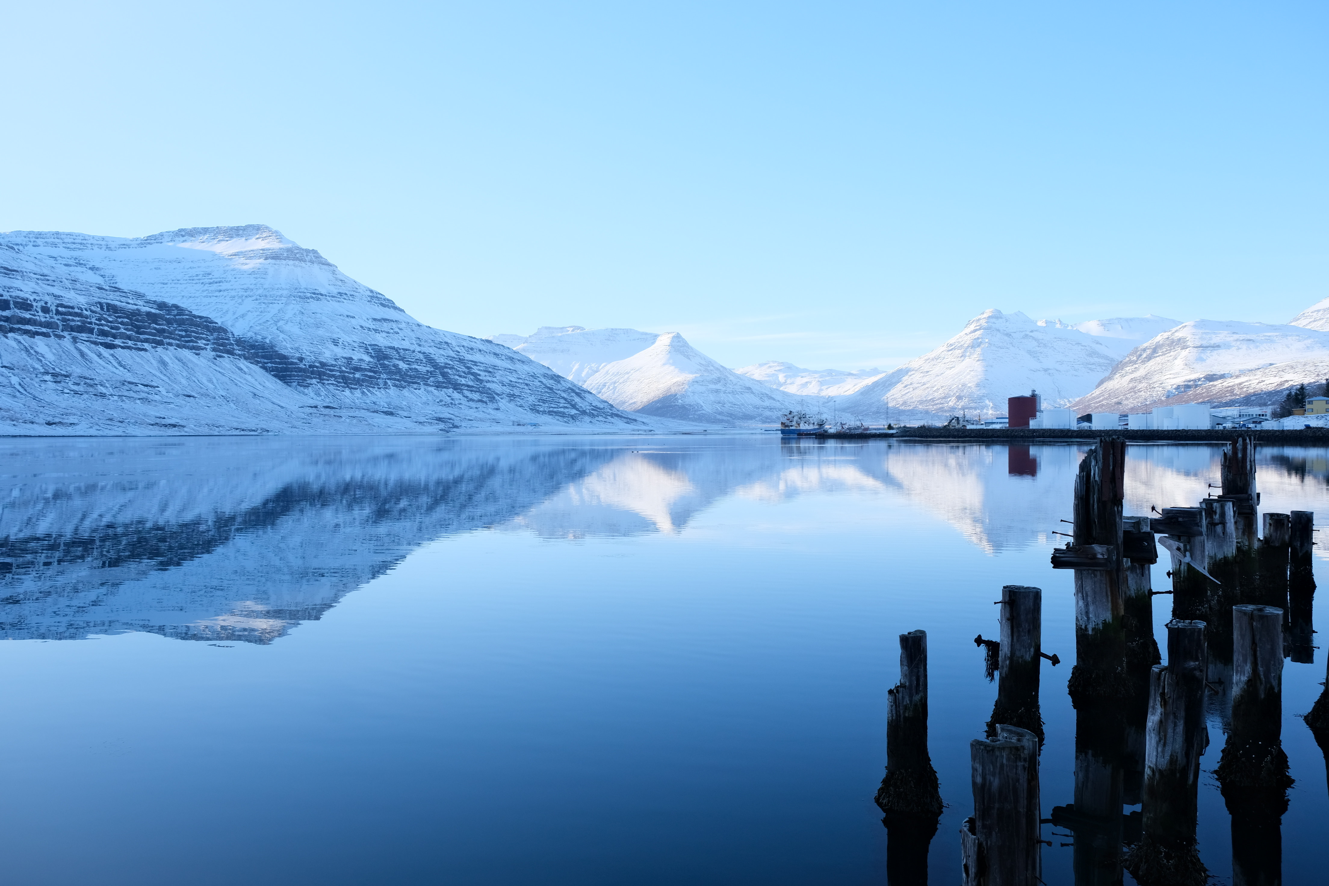
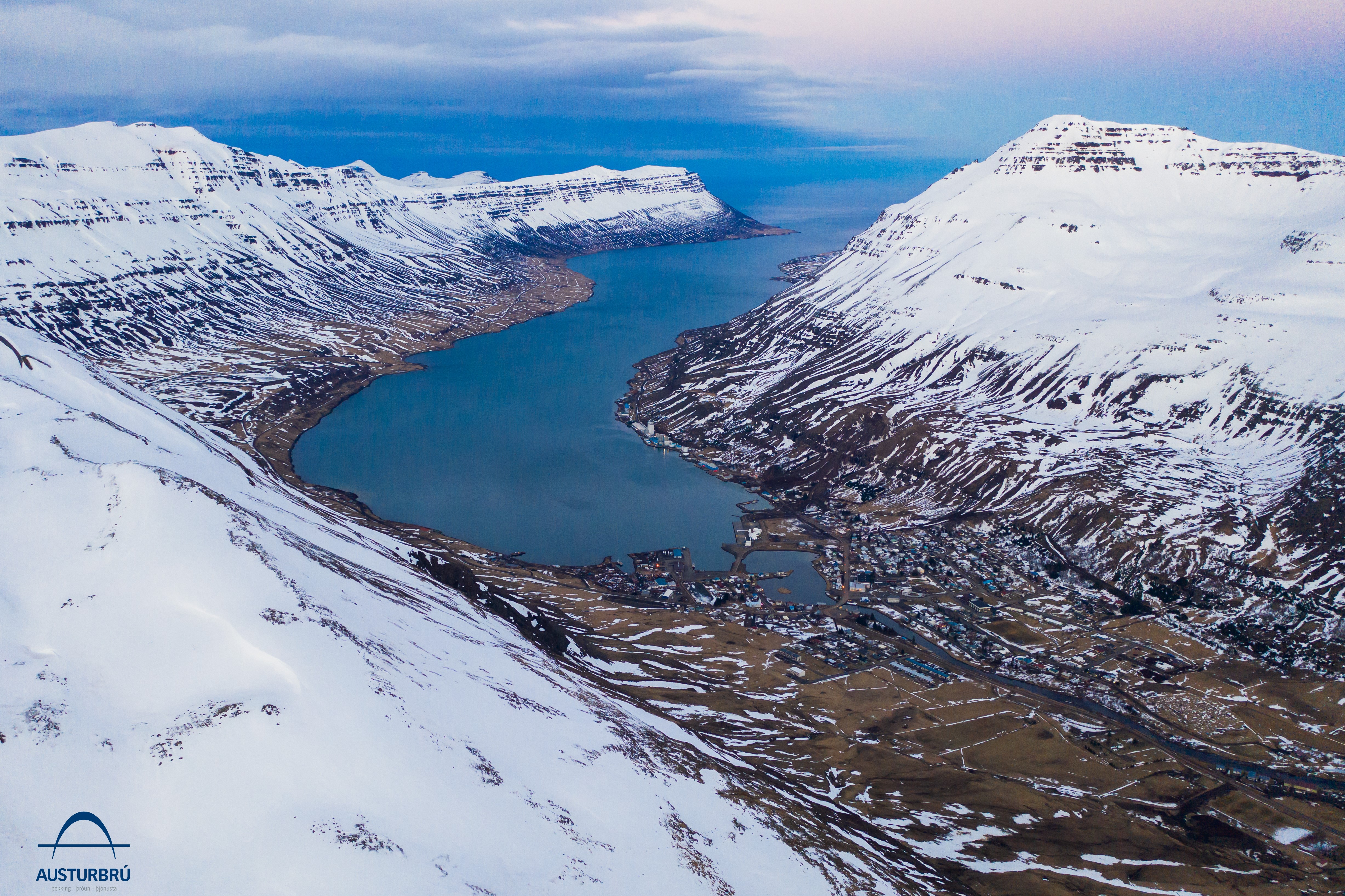
The demonstration site, the East Fjords in Iceland, constitutes several fjords in the east of Iceland: Seyðisfjörður, Norðfjörður, Eskifjörður, Reyðarfjörður, Fáskrúðsfjörður and Djúpivogur.

Description of the area
Biogeographical region: Arctic
Landscape context: Rural coastal fjord system framed by high, steep mountains
Total area: ~23 000 km²
Specific areas:
Seyðisfjörður
Reyðarfjörður (incl. Eskifjörður)
Norðfjörður

Climatic Challenges

Planned activities
The work in NATALIE is centred around the development of accurate mathematical models for hazard detection, the identification of combinations of suitable NBS that lead to better robustness, recovery and adaptability to the hazards following from climate change. Furthermore, models to map the consequences of the implementation of these NBS will be developed.
The NBS target the following objectives:
• NBS as effective conservation strategies: coastal protection and sustainable seafood production habitat suitability for flora and fauna,
• NBS for sustainable harvesting of seafood from fisheries and aquaculture,
• NBS for safeguarding local communities from natural hazards.

Progress
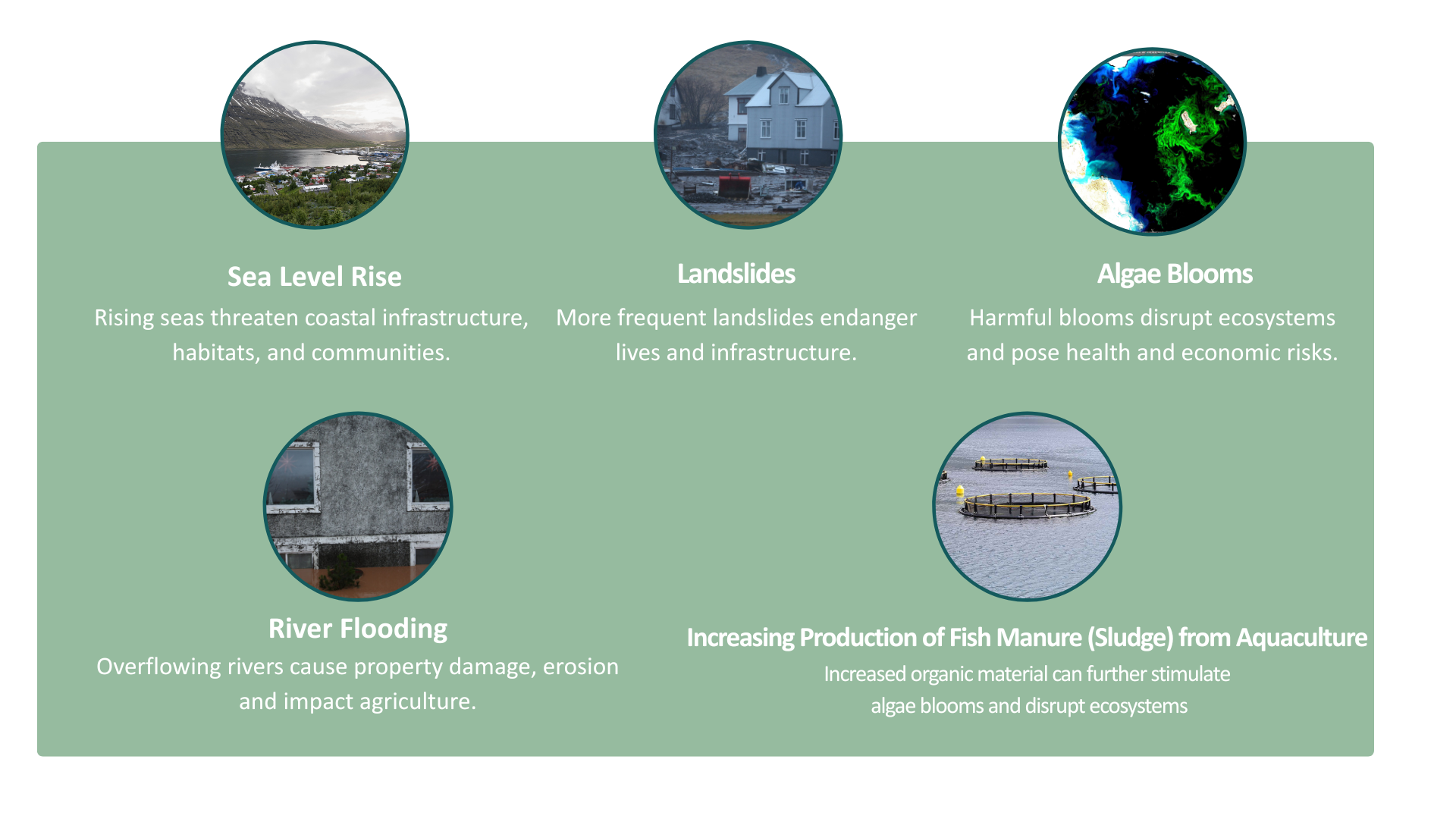
The CS7 initiative in the East Fjords of Iceland has made significant progress in modeling various natural hazards and exploring nature-based solutions (NBS) to mitigate associated risks. Key hazards identified in this region include landslides, sea-level rise, flooding, and algae blooms affecting water quality. A detailed assessment of potential NBS has been conducted, incorporating comprehensive descriptions, references, disaster risk reduction and climate adaptation benefits, additional co-benefits, feasibility, alignment with the UN Sustainable Development Goals (SDGs), and stakeholder identification.
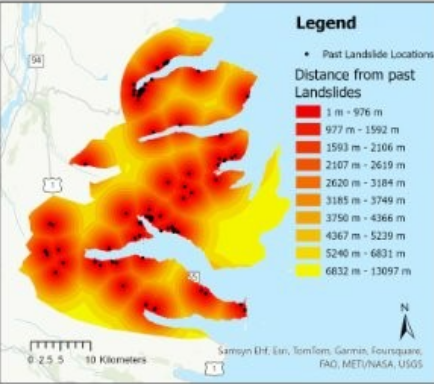
Extensive data collection has been performed, including a broad literature review on NBS relevant to Iceland and significant spatial-temporal data for multi-criteria decision analysis integrated with Geographic Information Systems (MCDA-GIS). Essential processes such as sea-level rise and landslides have been modeled by the University of Exeter (UNEXE). Consultations with experts from universities, soil sciences, and meteorological institutes have been instrumental in determining the feasibility and optimal implementation sites for these solutions.
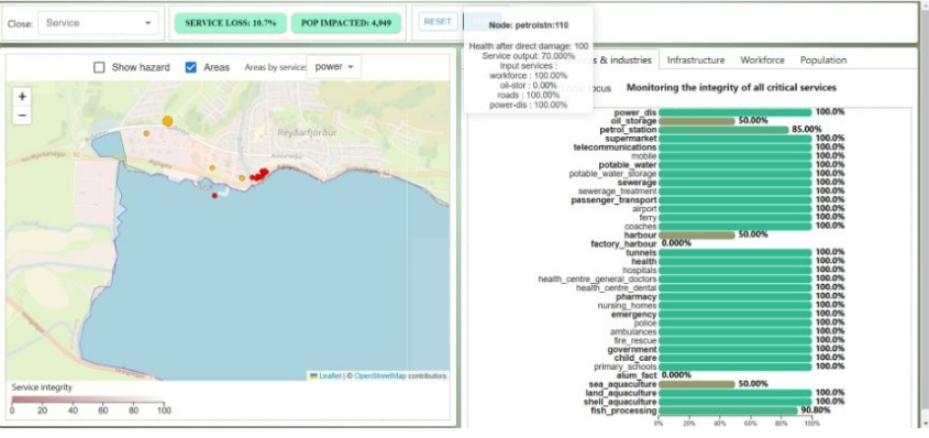
Further, advanced cascading failure modeling has been developed to evaluate the impacts on interconnected services, such as healthcare and fisheries, under varying stress conditions like workforce reductions.
Additionally, the initiative has advanced significantly in the assessment of algae blooms and water quality using Sentinel-2 satellite imagery. Employing gradient-boosted decision trees (LightGBM), a precise model classifying algae bloom severity based on World Health Organization (WHO) standards has been developed. A user-friendly web application is currently being developed to deliver daily predictive updates, enhancing both monitoring and response capacities.
A broad scope of natural hazards
Hazards identified in East Iceland:
Landslides, sea level rise and flooding, algae blooms and water quality
Scoping of all NBS for hazards – Via NBS Table.
Includes: Intervention Examples, Description, References, DRR Benefits, CCA Benefits, Co-Benefits,
Feasibility, SDG via ESG, Stakeholders Needed
Mass Data collection regarding all chosen hazards
Detailed literature review of potential NBS in Iceland and a large amount of spatial/temporal data for MCDA-GIS.
The process/hazard modelled so far by UNEXE (SLR and Landslides).
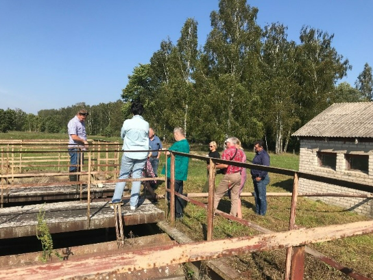
Spoken to external experts for advice
(i.e. Universities, Soil Experts, Met Office), this is of Key importance to identify the viability of NBS and suitable locations.
The interconnectivities and interdependencies between the services have been modelled, these different service condition have been developed using a curve. i.e. if workforce is halved how does this influence the service provided (healthcare/fisheries).

Ambition
Ambition during the project
To develop accurate mathematical models for hazard detection and mapping consequences of the implementation of NBS. To identify and develop suitable NBS for the area that are inclusive of traditional knowledge from local communities.
Ambition after the project
To protect the nature, environment and the communities in the East Iceland region.

Questions
Ever wondered how nature can help us tackle climate change?
NBS are “Solutions inspired and supported by nature, which are cost-effective, simultaneously provide environmental, social and economic benefits and help build resilience.”
European Commission, 2015.

Gallery

Leaflet

Involved partners