This page is also available in Italian ![]()
This case study consists of a Demonstrator Site. It does not have any Follower Site.
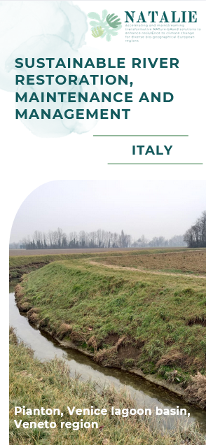
DS#8 - "Venice" (Italy)

The case study in 5 minutes

Location
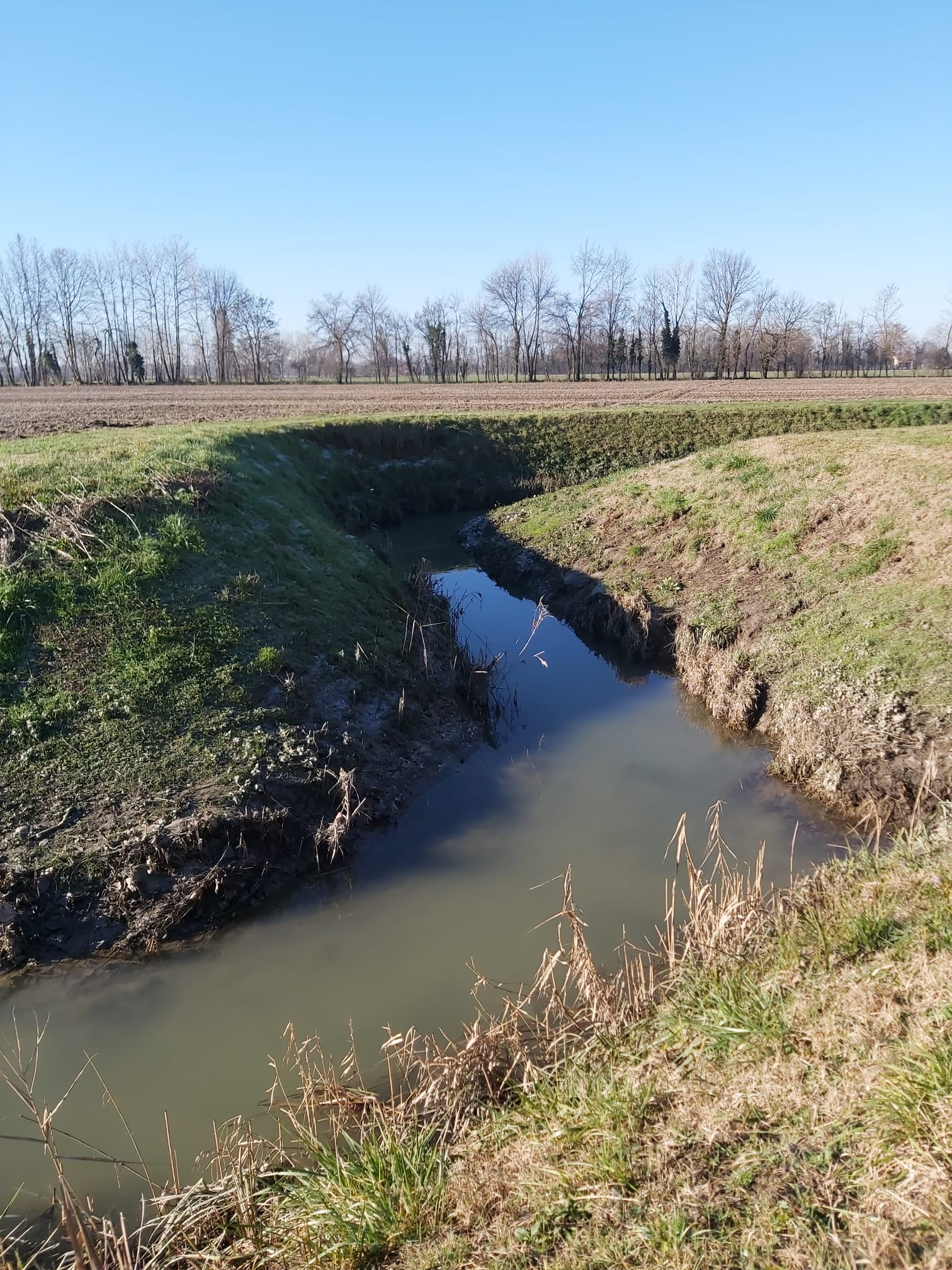
The demonstration site, the Venice Lagoon Basin, is located in the Veneto region in northeast Italy.
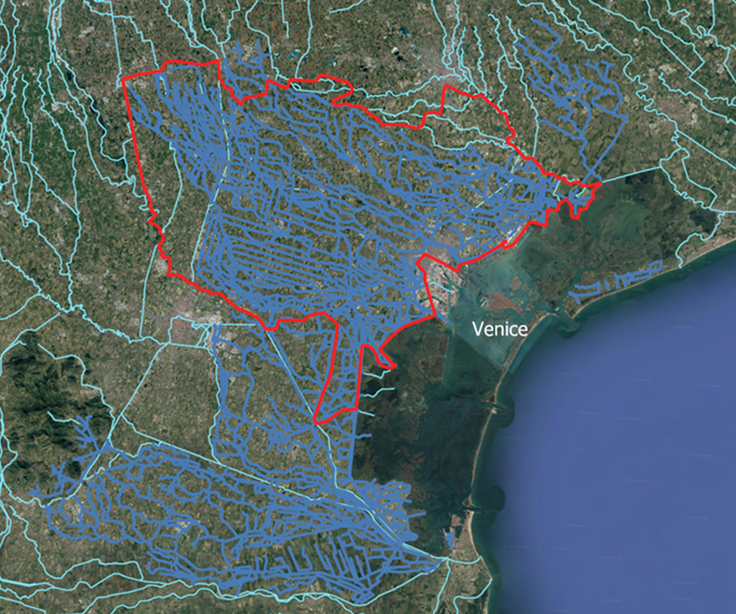

© The hydrographic network at the border of Venice Lagoon. Blue: rivers flowing inside the lagoon; Red: “Acque Risorgive” Land Reclamation Consortium competence area.
© Marco Cavallaro, Sebastiano Carrer
© Vittore Negretto – made with QGIS

Description of the area
- Biogeographical region: Continental
- Veneto ranks 2nd in Italy for soil consumption
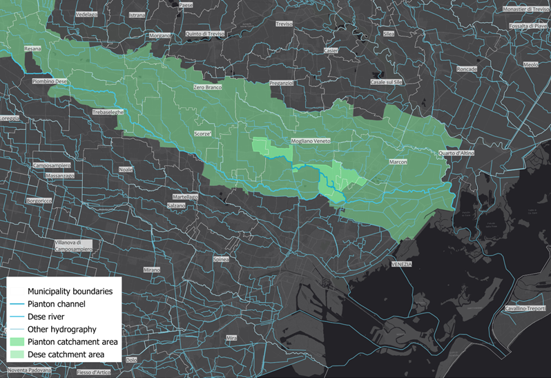
Drainage basin: 2,000 km² → 1,000 km² studied in NATALIE
Drainage network: ~2,300 km of streams
Region: Rural/agricultural, yet densely urbanized
Policy engagement: Veneto Region signed the EU Mission Charter on Adaptation

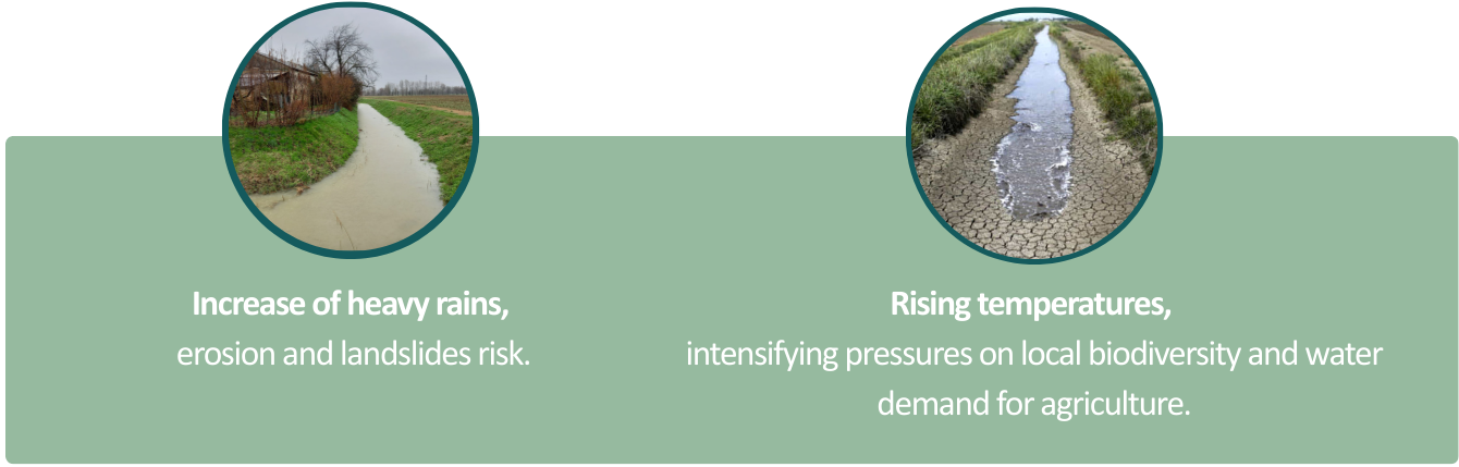
Climatic Challenges

Planned activities
Continuous river maintenance is the primary prerequisite for preventing landslides along their banks, and therefore represents a fundamental measure for preventing land flooding. Adequate and regular water flow in the network can also mitigate the risk of water scarcity for agriculture. Rising temperatures, in fact, not only affect the frequency of extreme storms and droughts, but also lead to increased water demand for crops. Revegetation will help reduce the risk of biodiversity loss and increase the potential for ecological connectivity with other green areas.
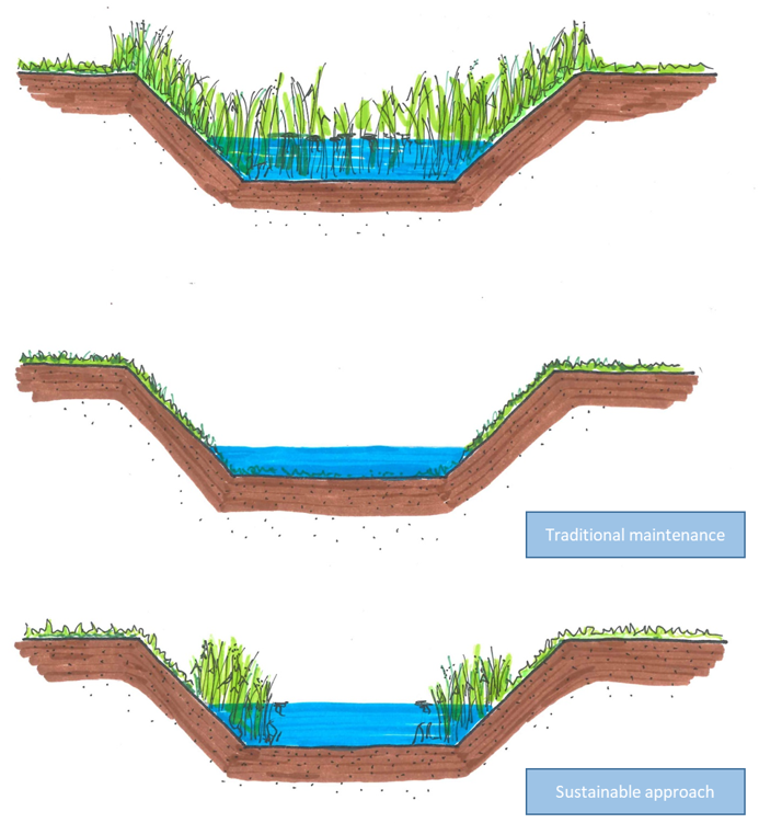
In DS#8 two types of NBS will be implemented and monitored: (1) “gentle” maintenance, (2) slope reduction and vegetation planting.
NBS1: “Gentle” maintenance
This solution is designed to ensure regular water flow and can contribute somewhat to erosion prevention. It involves maintaining a strip of untouched herbaceous vegetation at the base of the banks.
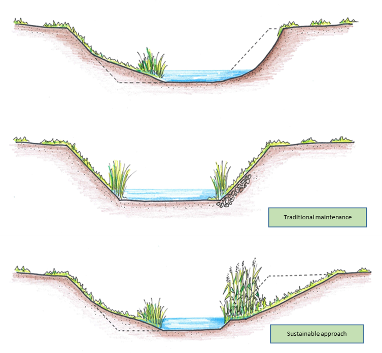
NBS2: Slope reduction and revegetation
La seconda NBS sarà utilizzata nei tratti del fiume dove sono già presenti frane. Verranno implementate una serie di attività:
The second NBS will be deployed in sections of the river where landslides are already present. A series of activities will be implemented:
Vegetation. Transplanting and revegetating the banks will also help consolidate the soil and reduce the risk of landslides, while also contributing to increased biodiversity.
- Strengthening skills. Workers in the sector will be trained to adopt the proposed approach. This will result in the development of new skills and the training of qualified workers.
Social awareness. A dialogue will be initiated with citizens and landowners. Farmers' associations in particular should be involved as key stakeholders.
Monitoring. This activity is essential for evaluating the progress of the NBS implementation process as well as the effectiveness and impact of the approach. Therefore, appropriate indicators will be studied throughout the project and then selected for monitoring.
The monitoring parameters will refer to both the environmental and social fields.
Environmental parameters will track changes in biodiversity, hydrology, and geomorphology. Social parameters incorporate indicators of capacity building and social acceptance.

Progress
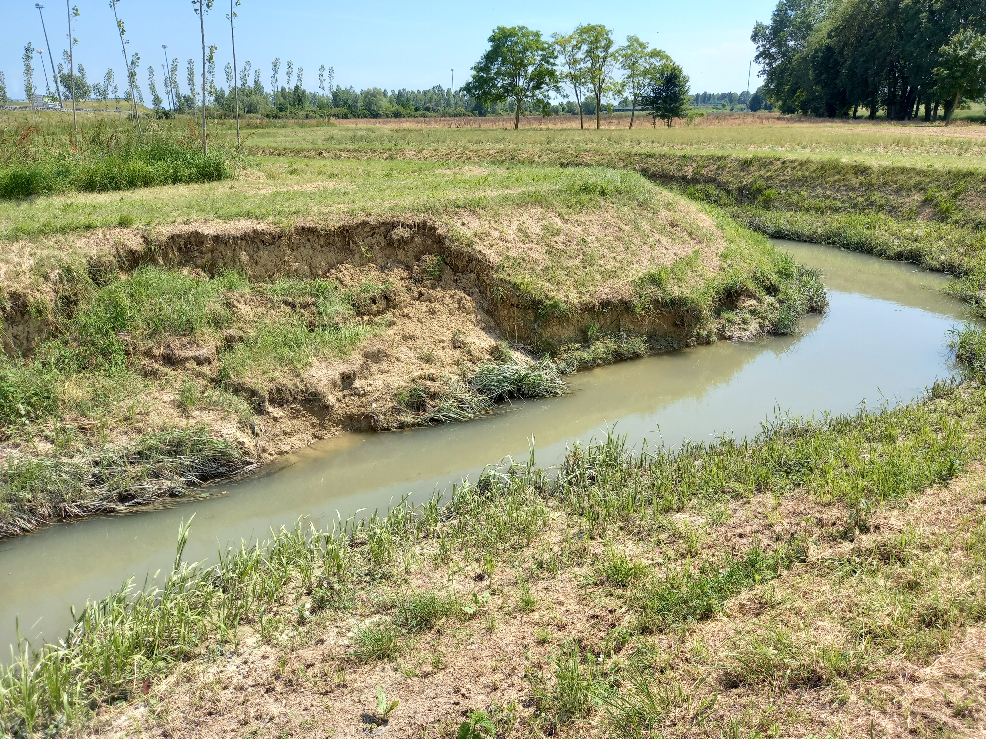
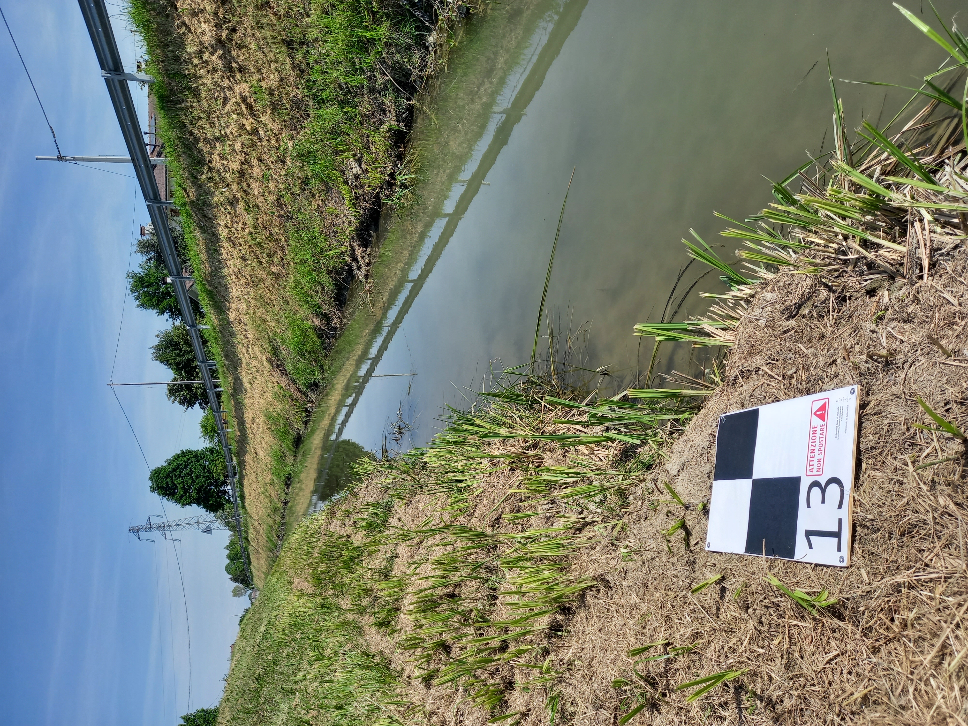
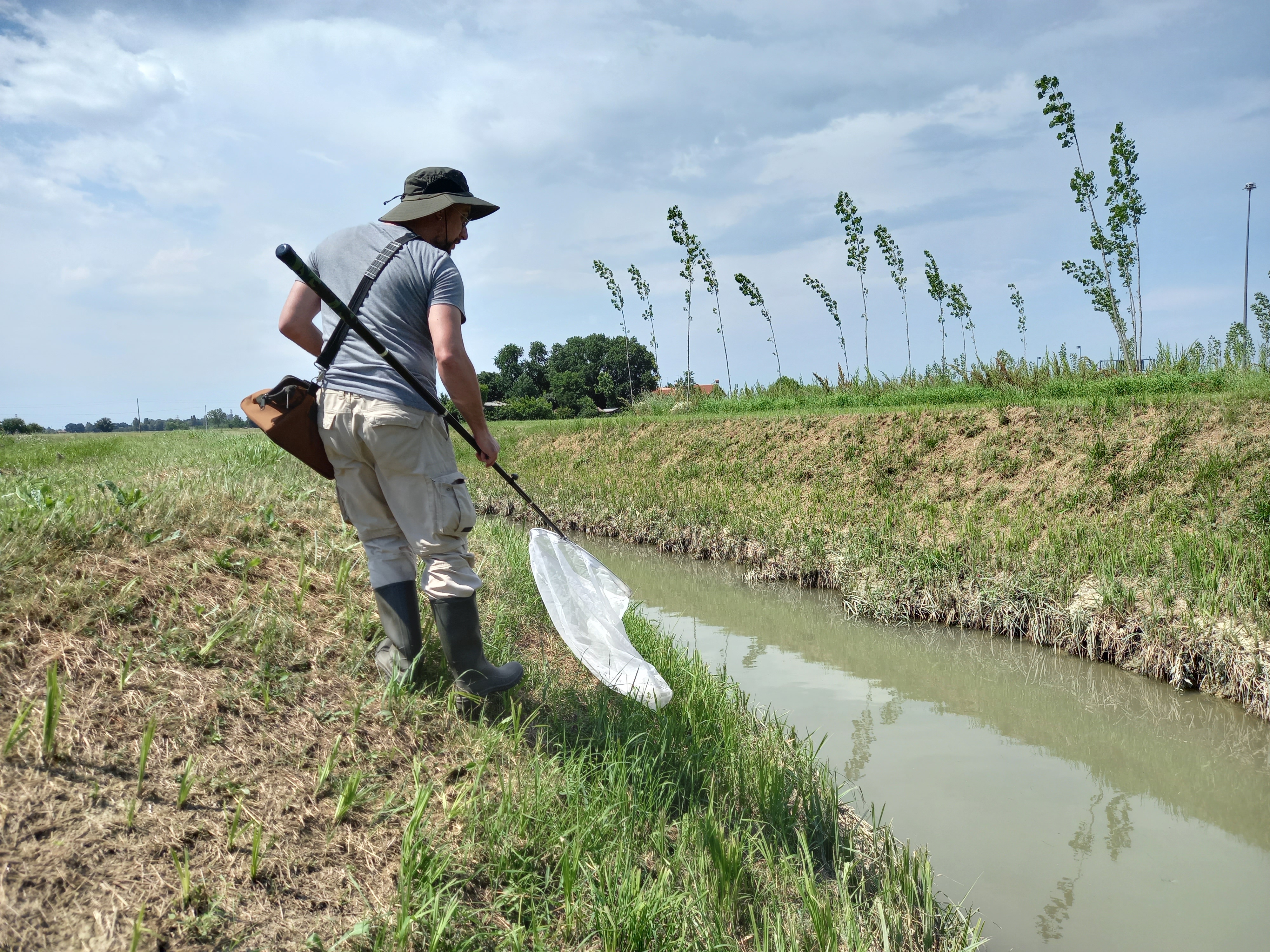
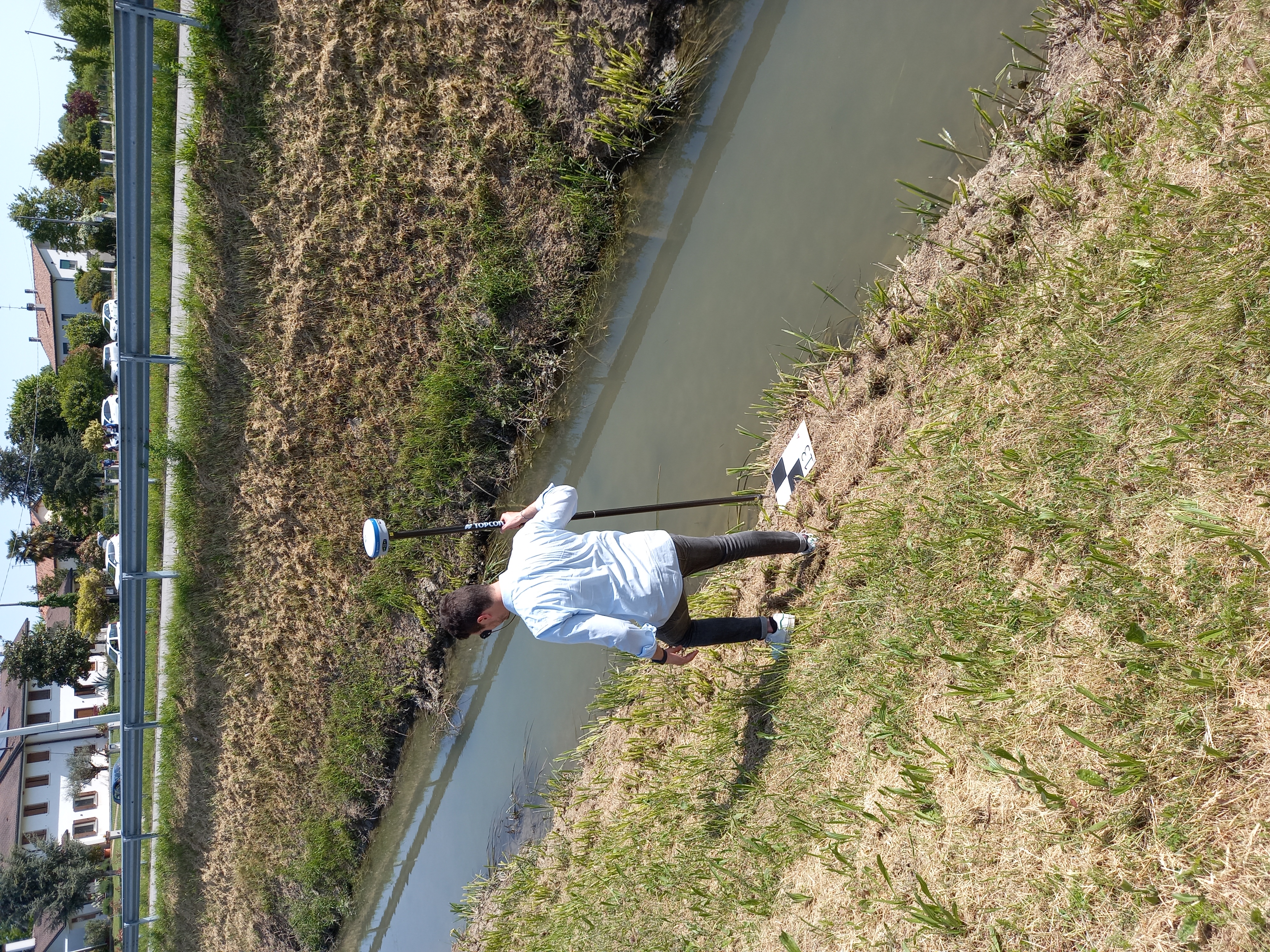
The Italian case study is currently experiencing a very positive phase: all activities are progressing according to the planned schedule, and the fieldwork has officially begun. The preliminary monitoring activities, essential for gathering data on the current state of the intervention area, have all been completed. In particular, the following have been carried out: topographic surveys, biodiversity monitoring (including birds, odonates, butterflies and vegetation), mapping of coypu burrows and characterization of the flow regime of the Pianton stream.
Moreover, thanks to measurements taken during several rainfall events, it was possible to calibrate a stage-discharge curve.
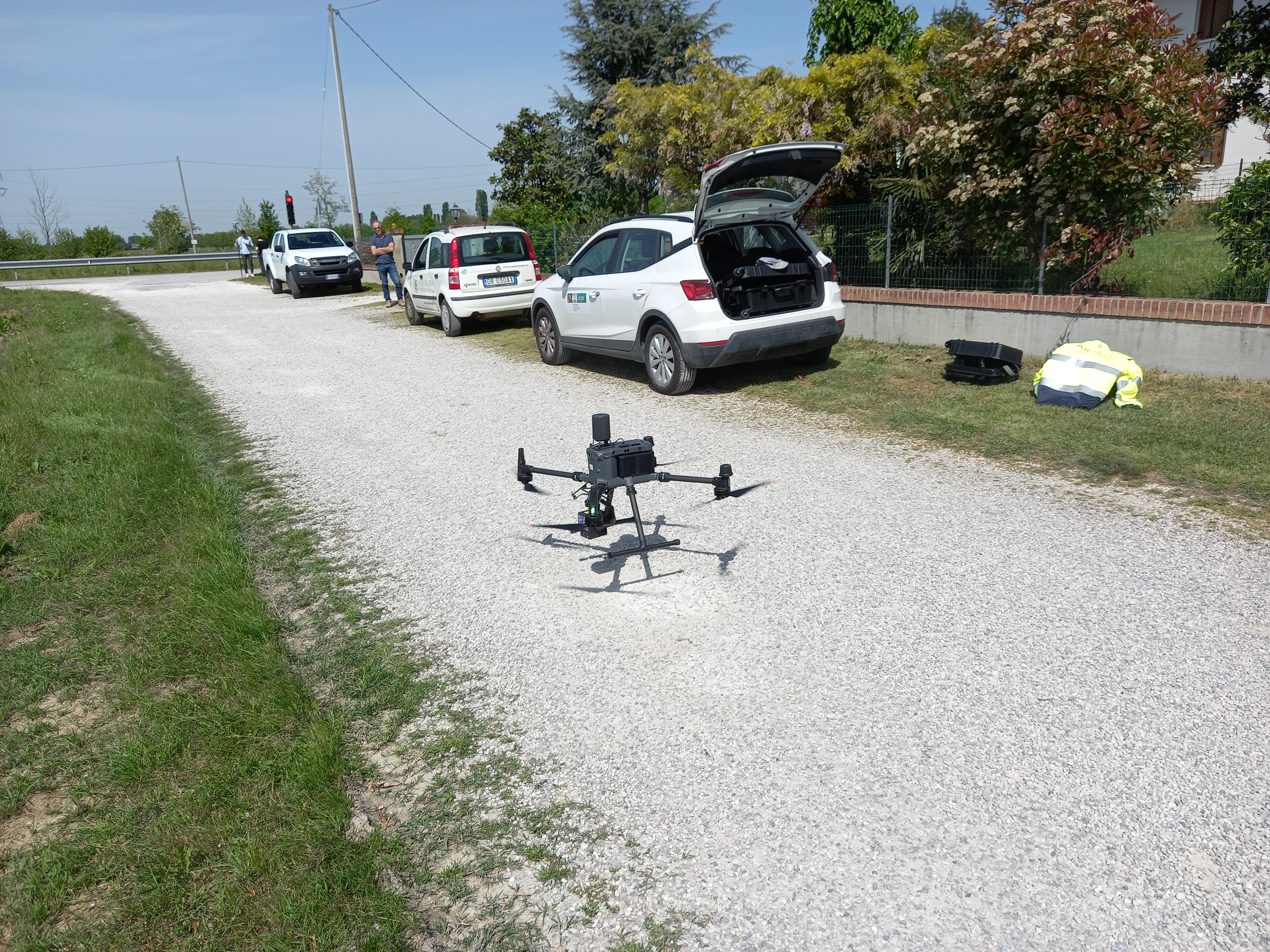
The topography of the site has been accurately documented through both ground-based surveys and the use of drones, enabling a fruitful collaboration with the Laboratorio di Geomatica of the Iuav University of Venice, the Veneto Region, and the Regional Environmental Protection Agency (ARPAV).
Another significant step forward concerns the acquisition of the intervention areas, which has now been completed. This made it possible to start the widening works on the Pianton stream, involving a modification of the bank geometry to improve flow and ecological function.
Stakeholder engagement activities are also ongoing. In July 2024, a Focus Group dedicated to stakeholders in the agricultural sector was launched. In November, the first workshop for the creation of the Transformation Labs took place in the Municipality of Mogliano Veneto. During this workshop, the groundwork was laid to develop a cost-benefit analysis for the entire project.
A second workshop will soon be organized to further encourage local stakeholder involvement. Meanwhile, on-site activities will continue with planting operations.

Ambition
Ambition during the project
NBS will be in place probably at the end of the second year, so at the end of the project, experience will be gained about the land acquisition procedure. Moreover, the monitoring the evolution of the site for at least a couple of years will provide evidence-based on the measure effectiveness and workers will have gained a new know how. Moreover, the solution will have been discussed with several stakeholders, mainly farmers association, hence increasing the social acceptance of the NBS implemented.
Ambition after the project
Implemented NBS will continue their function and the institution in charge of the maintenance will keep on carrying out the task, also to monitor the frequency needed for maintenance also in the medium-long term.

Questions
“Solutions inspired and supported by nature, which are cost-effective, simultaneously provide environmental, social and economic benefits and help build resilience.” European Commission, 2015

Gallery

Leaflet

Involved partners